

By Stuart Cakebread (Historic England), Emily La Trobe-Bateman (Historic England), David Myers (Getty Conservation Institute), and Nina Young (Getty Conservation Institute)
The contents of this blog post were originally published in British Archaeology magazine, the official publication of the Council for British Archaeology. We’re pleased to share the contents here on our blog, highlighting how the Arches platform is being used to support Historic Environment Records (HERs) throughout the British Isles as well as around the world. We have reformatted this article for the web and not all image from the original article are displayed here. If you’d like to see the article in its original published format, it appears in British Archaeology magazine, Issue 203 (July/August 2025). Digital access is available to CBA members via the magazine’s online portal.
Since its inception in 2012, the Arches Heritage Data Management Platform has been deployed by heritage organisations around the globe. To date, numerous organisations have implemented Arches both internationally and across the British Isles, including an expanding number of historic environment records (HERs). This has resulted in both progressively democratising access to historic environment information and enabling the public and specialist users alike to explore and use information about local communities and beyond.
HERs in the British Isles
Historic environment records (HERs) contain information about the historic environment for a defined geographic area. In the British Isles, we are fortunate to have a network of more than a hundred HERs that provide complete coverage. Together, they hold millions of unique records about monuments, sites, and landscapes: From prehistoric standing stones to twentieth-century Cold War sites, from medieval churches to designed parks and urban spaces.
HERs play a vital role in forming public understanding and enjoyment of the historic environment; they provide information that underpins sustainable conservation, planning decisions, and land management, including forestry and farming schemes. In both England and Wales, the importance of HERs has been formally acknowledged through statutory protection.
HERs typically include records for monuments, alongside reference material that supports their identification and interpretation, referred to as source records. HERs also record activities that result in the collection of primary data about the historic environment: Event records include, for example, building surveys, archaeological excavation, and scientific surveys.
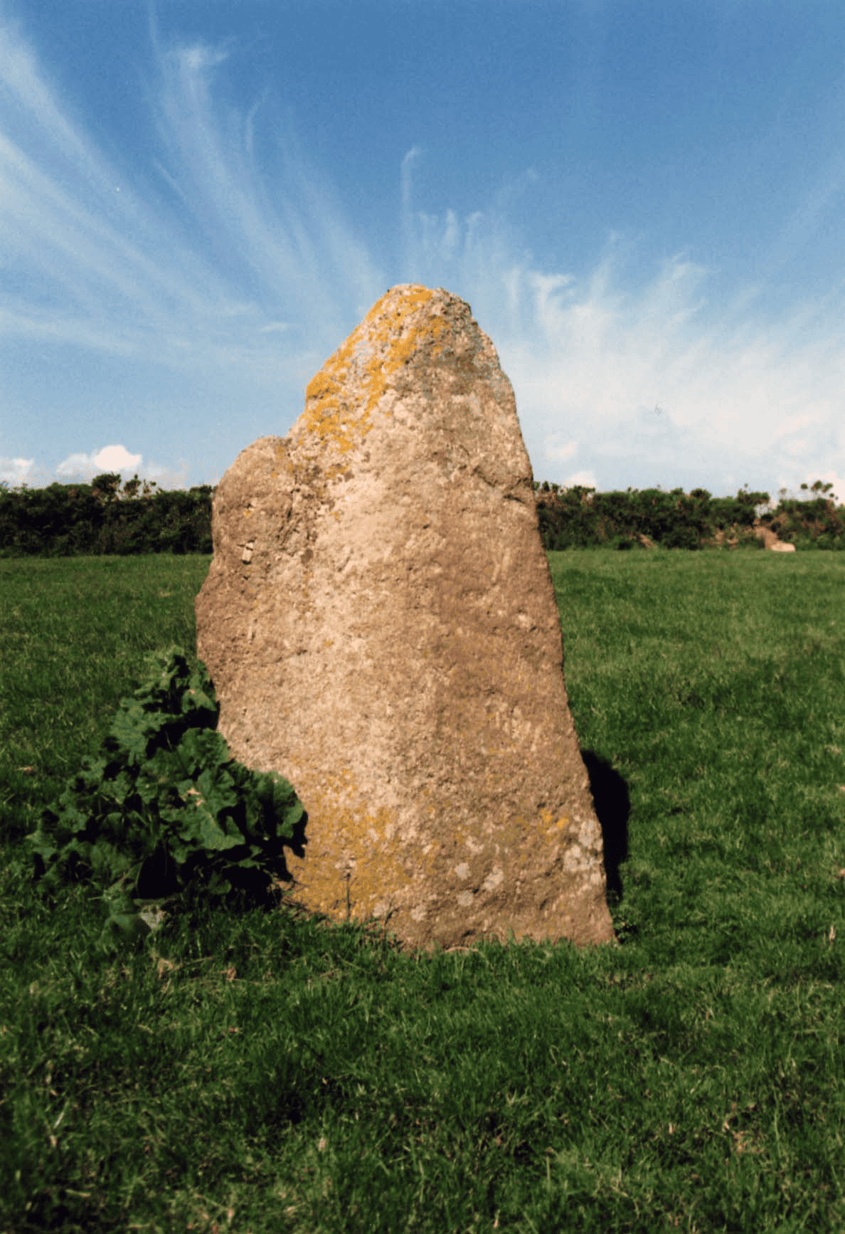
Many important sites, such as Kemyel C, standing stone in Cornwall, are not protected as nationally significant monuments but are recorded in the local HER, in this case the Cornwall and lsles of Scilly HER. Image credit: Payne, R & Lewsey, R, 1999, The Romance of the Stones: Cornwall’s Pagan Past.
The painstaking, expert work to collate these diverse sources of information has been going on for more than 60 years. HER records are unique, making each one an irreplaceable resource: However, it is their dynamic character and link to digital mapping that have given them salience in the twenty-first century.
HERs are constantly evolving, maintained by a dedicated community of historic environment professionals. Their scope and character continue to develop through research and investigation, each one reflecting the local circumstances in which they were created and have grown. While many are based in local authority planning departments, others are found in museums and universities.
HERs exist within a broader community of existing memory institutions, traditional holders of knowledge such as museums, archives, and libraries. They cross-reference datasets and resources, providing an index to the existence, quantity, and quality of these sources of information for the geographic area that they cover, including data and archives held elsewhere in the HER, or by other organisations.
Some HERs are very large: Kent, Cornwall, and Devon, for example, include more than 100,000 records each; others are much smaller, with a handful containing less than 4,000 records. Their variability extends to accessibility, particularly remote, digital access. Although many HERs can be accessed online, not all can.
Work is currently under way at local and national level to improve knowledge of and access to HERs for everyone: The public, researchers, volunteers, property owners, heritage professionals, and agencies. These innovations underpin the ability of HERs to respond to challenges such as the climate emergency and the need to streamline digital planning services.
They demonstrate their continued development and the pivotal role HERs play in the data ecosystem–a role that is only set to become more urgent and important.
For more information see an online overview of HERs, past and present: https://khub.net/web/uk-her-manual/home
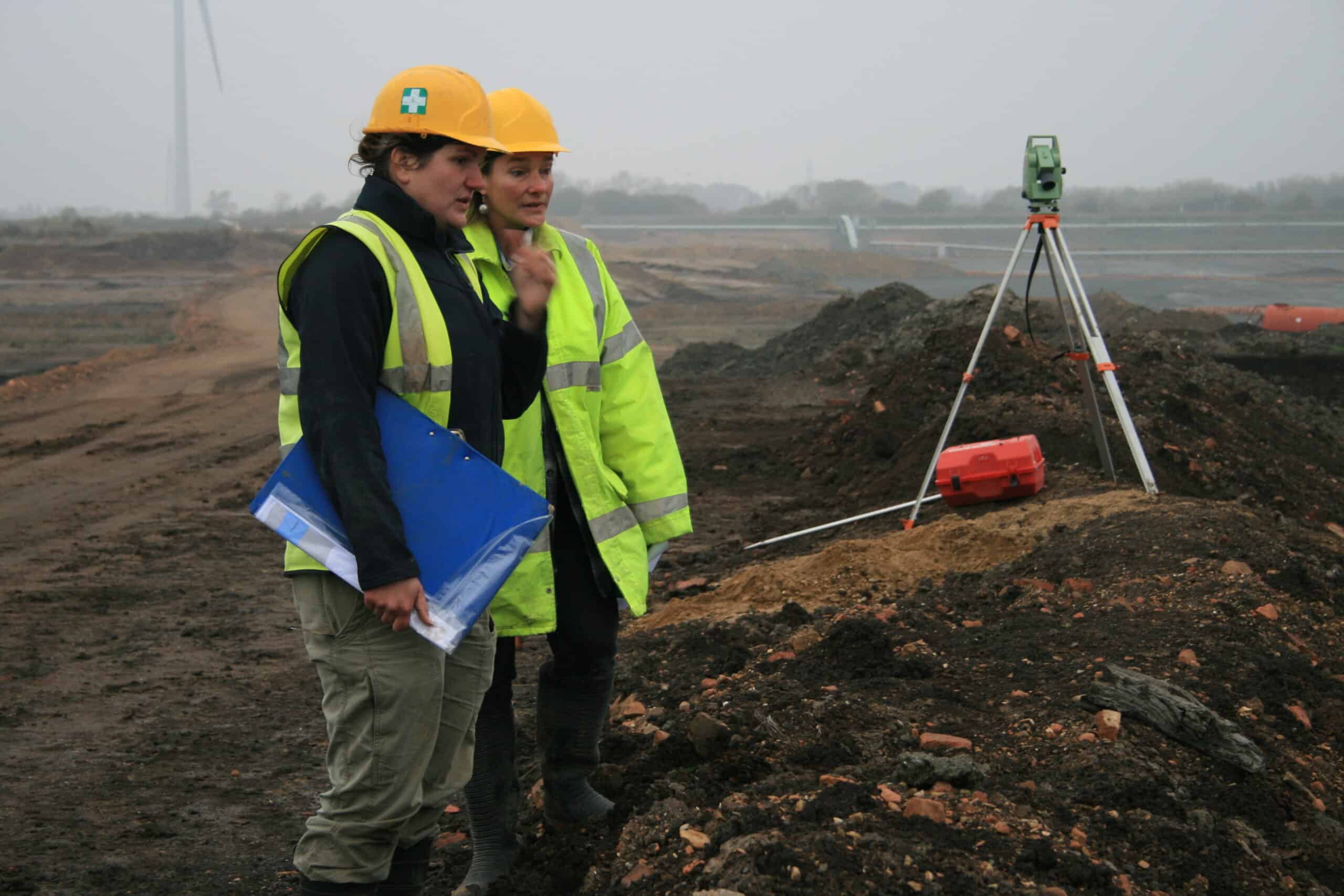
HERs record activities (‘events’) such as building surveys, scientific surveys, and archaeological excavations; this example from Cambridgeshire HERs hows archaeologists Kasia Gdaniec and Keny Hopper discussing Must Farm Palaeochannel Investigations, Cambridgeshire. Copyright Cambridgeshire County Council.
Why Arches?
HERs can reach their fullest potential through modern information technologies that offer quick access to key information, and a system that allows for records to update with ease to reflect changing conditions. However, maintenance of complex systems is costly and can be challenging for heritage organisations that face funding and staffing limitations.
In 2012, the Getty Conservation Institute (GCI), and its original partner World Monuments Fund, recognised a long-term trend of diminishing resources for heritage organisations internationally, as well as the essential need for software that can accommodate the complexity, scale, and diversity of heritage data. With this in mind, the partners created the Arches Heritage Data Management Platform. At the inception of the Arches Project, the GCI engaged Historic England (then called English Heritage) to harness its expertise on heritage data standards, as well as heritage inventories, as input to the initial design of Arches.
Historic England has continued to provide technical guidance to the Arches Project since then. The needs and expertise of hundreds of heritage professionals from around the world have informed and guided Arches since the beginning of the project.
Arches is open-source software, enabling cultural heritage organisations worldwide to download it for free, customise it to their needs, and avoid costly ongoing licensing fees. It should be noted that Arches is designed to be run by an organisation or a project team, rather than installed on personal computers.
Its development is guided by heritage professionals rather than large for-profit tech companies. While commercial solutions often lock organisations into contracts that give companies control over the software and data, Arches ensures heritage organisations retain full ownership and sovereignty over their system and information.
The open-source approach also engenders a collaborative environment for a community of implementers that have similar needs, providing an option for organisations to pool resources towards necessary software enhancements reflecting common needs.
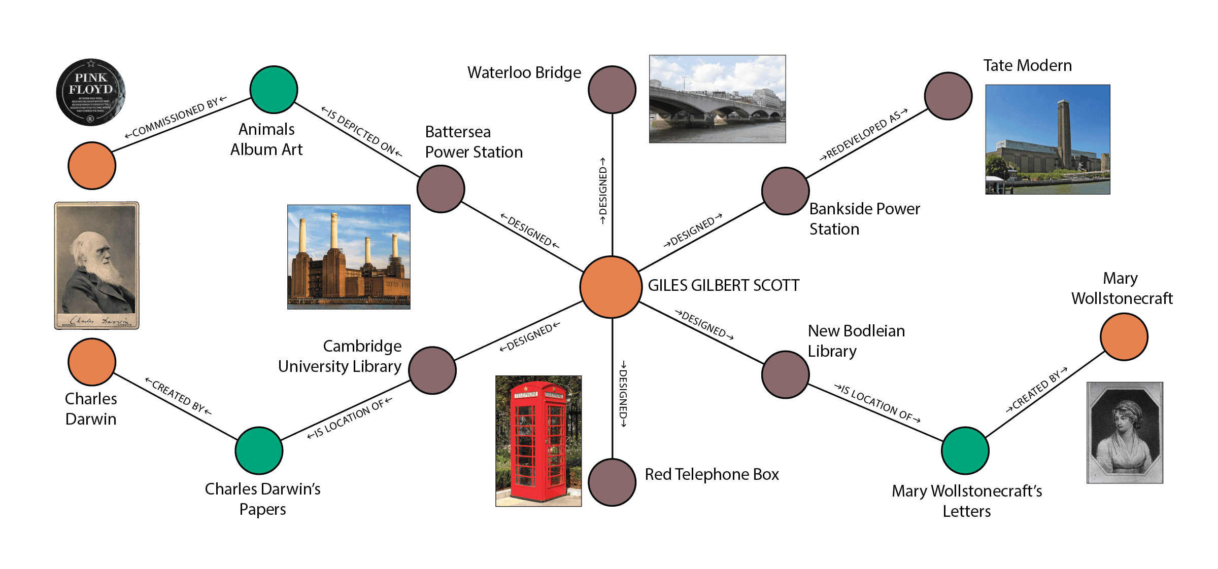
Arches users may visualise relationships between different data types and resources through an interactive graph. This example of such a graph shows relationships between architect Giles Gilbert Scott and buildings and structures he designed, as well as further related archival materials, artworks, and other persons. Image credit: *
Arches is purpose-built for heritage stakeholders
Data created and managed by heritage organisations is often complex (e.g. hundreds of artefacts excavated from an ancient settlement during multiple investigations by differing organisations), and contains uncertainty (e.g. date of establishment and abandonment of that ancient settlement).
Arches enables users to readily create and edit information representing both complexity and uncertainty, including tracking sophisticated relationships linking heritage items, events or activities, persons and organisations, and documents. Arches additionally allows implementers to customise controlled drop-down vocabularies, which supports both consistent data creation and indexing information for discovery through searching.
The core platform incorporates internationally adopted standards for both heritage information and information technologies. These standards facilitate robust data findability and usability, including widespread integration with other data management tools.
Arches also uses common nonproprietary digital file formats to save the knowledge entered or migrated into the platform, producing data usable by other information systems and for the long-term. In these ways, Arches structures data to enable organisations to maintain the integrity of their heritage information into the future.
Arches is web browser-based to allow for broad access to anyone with an internet connection. Access, however, can be controlled at a detailed level based on individual or group privileges. An implementer can choose, for example, which users may edit which data or when public access is allowed, including what types of information may be viewed.
The interface is designed to be as intuitive as possible so that most users require minimal technical training. Through Arches’ internationalisation, its user interface may also be readily translated into languages of any script. Additionally, through software enhancements provided by Historic England, Arches complies with web accessibility standards, which is particularly important to visually impaired users.
Arches gives users a variety of tools to facilitate data visualisation and discovery, including a map interface that can integrate historical maps and satellite and aerial imagery, allowing historic landscapes to be explored geographically.
As mentioned, Arches provides for establishing relationships within data and visualising those relationships through an interactive graph. For example, the graph can display relationships between a heritage site or object and historic events, investigative and conservation activities, scientific or other scholarly reports, associated people, and organisations.
Linking this information to dates or other temporal attributes allows visual time-based searches using the Arches Timewheel.
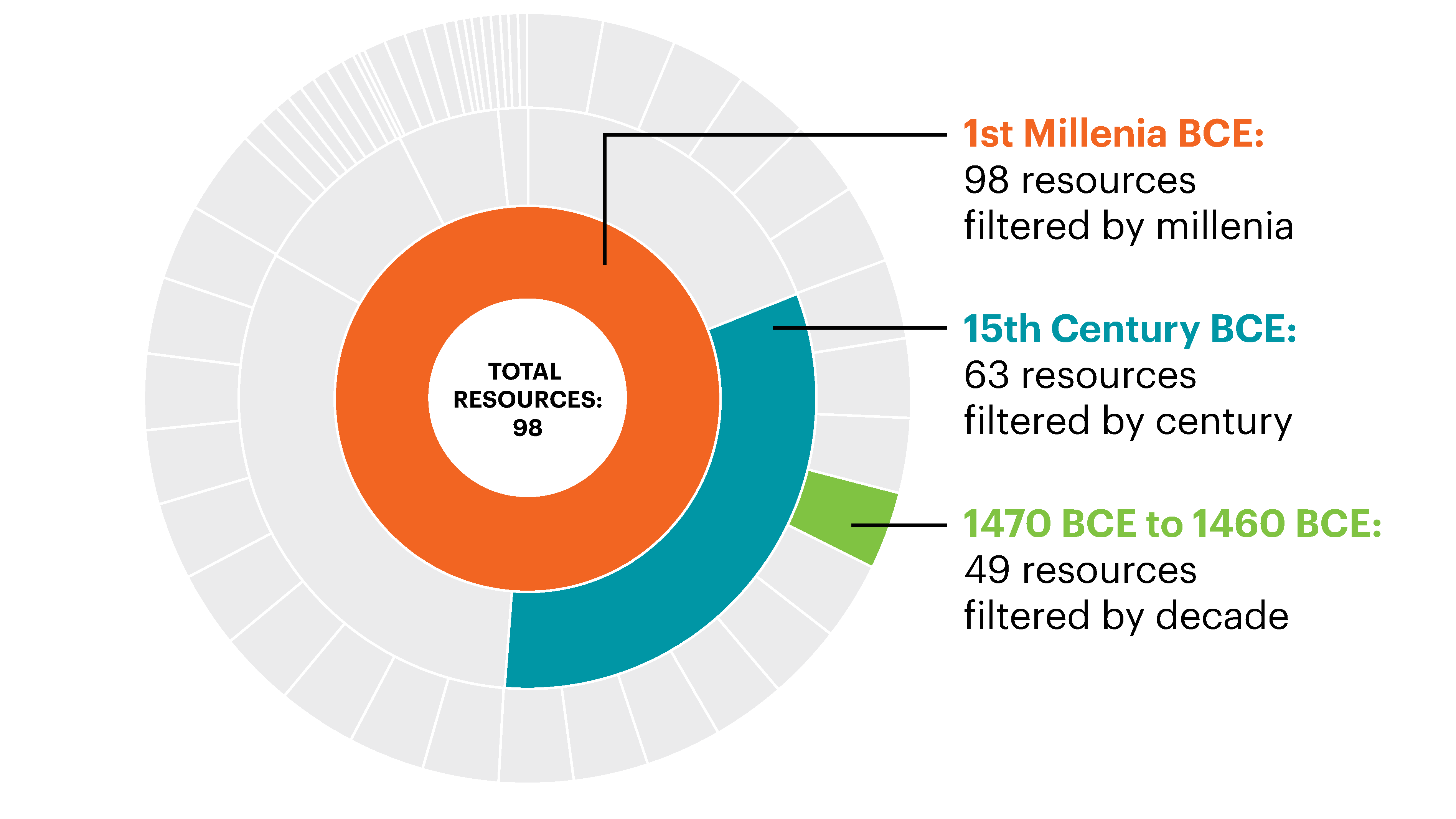
The Timewheel is a circular histogram allowing users to filter data based on a time period e.g. a millennium, century, or decade. The size of each time period segment represents the frequency that period appears in the data. Image credit: Getty Conservation Institute.
Arches also allows organisations to automate their business processes through customising task management workflows. For example, as described later in this article, Historic England personnel who manage the Greater London Historic Environment Record (GLHER) deployment of Arches use a custom workflow to assess development applications and their potential impact on historic environment sites.
Arches’ capabilities are continuing to expand. The initial version of Arches for Science has been released, which is an extension of the platform designed to help heritage scientists and others to secure, retrieve, visualise, compare, and share scientific data, and to track technical examinations of heritage items. And, with expert input from Historic England, the development of Arches Lingo has begun, to provide organisations more control to integrate, combine, and manage their local vocabularies and thesauri, helping ensure consistency of data entry, and greatly improving search results.
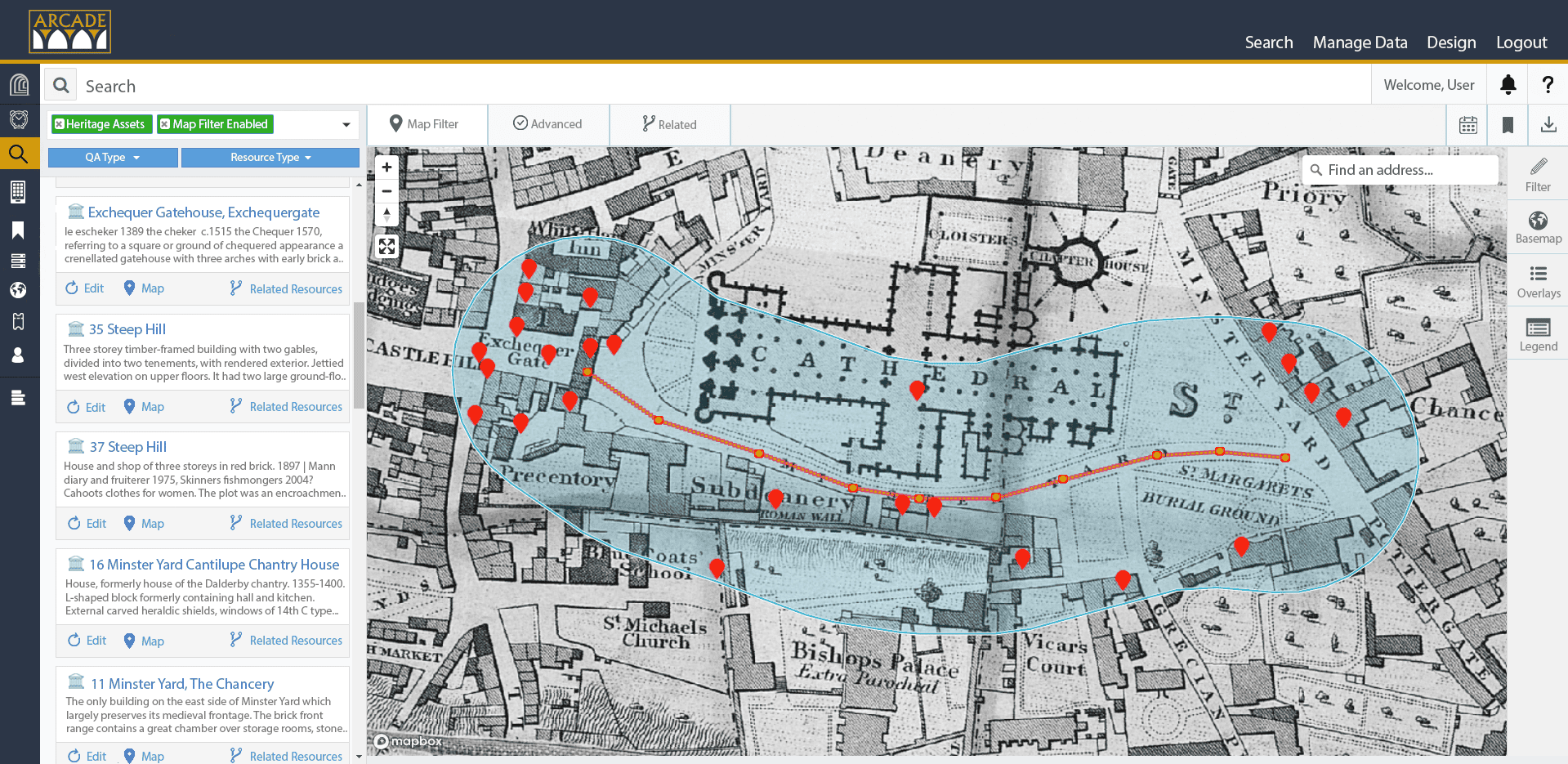
Using the Location Filter in Arches, users can spatially query data by drawing a line or an area and specifying a buffer size, viewed here over an underlaying 1842 base map. This search functionality may be used to identify heritage resources that would be impacted by proposed development projects in this example from the City of Lincoln Historic Environment Record (HER) deployment of Arches. Image credit: Arcade, courtesy of City of Lincoln Council.
Historic England’s role in the Arches project
Historic England, the UK Government’s statutory adviser on all matters relating to the historic environment, has a long involvement in the development of the Arches platform, as noted before.
Recognising the power and flexibility of the Arches software, Historic England has been keen to implement Arches to manage its own heritage inventory data. Currently, Arches is used to manage the National Record of the Historic Environment, a collection of over 550,000 records from the earliest times to the present day. Arches is also being implemented to manage and share information about the marine historic environment, including the National Marine Heritage Record (NMHR).
The NMHR covers sites that lie between mean high water and the 200 nautical mile sea limit, the tidal extent of rivers, estuaries, and creeks. It contains records for over 37,000 shipwrecks; of these, approximately only 6,000 are identified wreck sites, around 7,500 are unidentified seabed obstructions, and 1,000 isolated find spots.
Creating Arches for HERs for the UK historic environment sector
Seeing the potential of Arches, in November 2016, Historic England and the City of Lincoln came together with the Getty Conservation Institute to form a partnership to develop a new historic environment record system for both the City of Lincoln and Greater London using the Arches platform. A system which could be used by all historic environment records in the UK.
Arches for HERs
Arches for HERs is providing the sector with a twenty-first-century system that is data-driven and standard-based to support better decision-making and wider community engagement.
Being open-source and freely available, Historic England believes it to be a cost-effective alternative, one which can help limited local authority budgets spread a little further.
Users can find reliable information quickly, and online, making it easy for developers, consultants, and local authorities to identify potential risks or opportunities at an early stage, and facilitate community groups and others to better understand and love their local heritage.
Background to GLHER/GLAAS
The Greater London Historic Environment Record (GLHER) is not only one of the largest HERs in the UK, it covers the 33 boroughs that make up Greater London and has the unique distinction of being the only HER managed by Historic England.
It came into being in 1982, when the Historic Buildings Division of the then Greater London Council (GLC) set up the Greater London Sites and Monuments Record. Although one of the last to be set up, it was one of the first to consider recording information on both archaeology and historic buildings together, which is now standard practice.
Responsibility for the record passed, with the abolition of the GLC, to the Museum of London, but since the early 1990s it has been maintained and managed by English Heritage/Historic England as part of the Greater London Archaeological Advisory Service (GLAAS).
The GLHER’s primary use has been as a technical specialist dataset, helping inform planning and other land use management decisions across the capital, a diverse urban environment that experiences intense development pressure. Its potential to engage Londoners by raising awareness and enjoyment of the capital’s heritage and its management had been held back by its inaccessible IT system.
The GLHER system contains nearly 100,000 records on the historic environment, or relating to information on the historic environment, and currently receives an average of 700 data requests a year, mostly from archaeological units and consultants as part of the planning system. The results of their research or excavations are then fed back into the GLHER system.
Why Historic England wanted Arches
Given the high level of development in the capital, it is no surprise that the vast majority of external engagement with the GLHER has been through the planning system, namely developers and heritage contractors. However, the GLHER is an invaluable dataset for everyone, including academics and the public interested in London’s heritage.
Public, or community-based, involvement is vital, not only with helping to develop the GLHER by making its content more accessible, but also through the planning system; to develop a further understanding and care of the historic environment, and to encourage more engagement in how public places and community spaces, are shaped in the future.
Enhancing the legacy of local societies, many of whom were integral to the input of early records, added to the GLHER in the 1980s. The system previously used by the GLHER operated under a licence scheme. This limited access to the HER, precluded extending its use across external partners, such as planners in the London boroughs, and restricted the number of potential volunteers the GLHER could host.
Prior access to the GLHER was limited, it meant either requesting an information download ‘blind’, making an appointment to visit the GLHER team and navigating an unfamiliar system, or relying on subsets of the GLHER data held on the Heritage Gateway or via the Archaeological Data Service’s website.
Now, using the web-based Arches platform, users can view full live data populating the HERs, with only planning-related records restricted and sensitive sites withheld. Having this resource means that heritage colleagues in the London planning authorities can directly view GLHER information to help inform decision making, rather than having to wait to get the information from the GLHER subsequently archaeological units and heritage consultants can begin to consider any heritage implications on planning related sites earlier, while waiting for the GLHER team to process their enquiry.
Internally, Arches has had a positive impact on GLAAS, helping to record information in ways that previously were unavailable. For example, the GLHER can process HER enquiries more efficiently and quickly, and GLAAS archaeological advisers use new built-in workflows to simplify and speed up their management of planning cases, so that site visit details, correspondence, and advice are all held in one place.
GLHER volunteers
Moving to an Arches-based system has also meant that the GLHER has been able to expand, a long-held ambition, to equip its team of volunteers in a cost effective and convenient manner, allowing remote access to the system, either in the GLHER office or at home.
The GLHER has for many years welcomed volunteers, whether interested individuals, those seeking work experience in the heritage sector, or as part of an interest group.
Individuals work alongside the HER team, helping to enhance our HER data outside of the information received through the planning system. Workhouses, First World War auxiliary hospitals, sites, and finds along the foreshore in Wandsworth, and London squares are among the projects our volunteers have worked on.
Thanks to Arches, and the publicity of the launch of the GLHER online and Arches for HERs in September 2024, the GLHER now has nine volunteers and it is now looking to expand the team further in 2025. By doing this, it emphasises the importance of involving a wider range of people and perspectives in researching London’s heritage.
By empowering users, with the help of the GLHER team, to conduct their own research and analysis, the GLHER can encourage focus on areas of greatest interest to communities and embed local knowledge to create accessible records that appeal to a broader audience.
While it is fantastic that the GLHER is increasing its volunteer numbers, and will be looking to expand this group further, there is a capacity limit as the GLHER team needs to be able to both support and help our volunteers and still cover our extensive day-to-day work. This is something we are currently trialling with two of our volunteer groups.

HER volunteers from the Friends of Greenwich Park using the GLHER Online to update Park records. Image credit: Stuart Cakebread.
London Parks and Gardens Trust
One of the GLHER’s longer-term projects has been a collaboration with volunteers from the London Parks and Gardens (LPGT) to import data from their inventory so that it is available to planners, developers, and local authorities, by adding it to the GLHER.
The inventory contains over 2,650 The inventory contains over 2,650 entries of parks and gardens which are not only thought to be of national importance but also includes smaller green spaces, which add to London’s historic landscape and help improve community wellbeing.
This work involves additional research through records and mapping available through the GLHER, which in turn is fed back into the LPGT inventory. Mutually beneficial to both organisations, this work offers a dual purpose: Cleaning and updating the LPGT inventory records while sharing data to a wider audience alongside related heritage information through the online GLHER.
The Friends of Greenwich Park
The Friends of Greenwich Park are one of the new volunteer organisations the GLHER has engaged with since the launch of the new online HER. The Friends of Greenwich Park were formed in 1992 to help improve and conserve the park and have been involved in archaeological works which have taken place as part of the Royal Park’s ‘Greenwich Park Revealed’ project.
Working with the GLHER team, the Friends have begun to review what datasets the GLHER holds for Greenwich Park. Using their knowledge, and with further research, either independently or alongside the Royal Parks’ community archaeologist, they are updating and adding information to the GLHER records.
Engagement with the voluntary sector allows the GLHER team to better understand the training needs of their volunteers and researchers. A salient reminder to the team that technical concepts HER Officers find easy to grasp, coupled with the breadth of content and recording standards, may feel challenging or overwhelming to others.
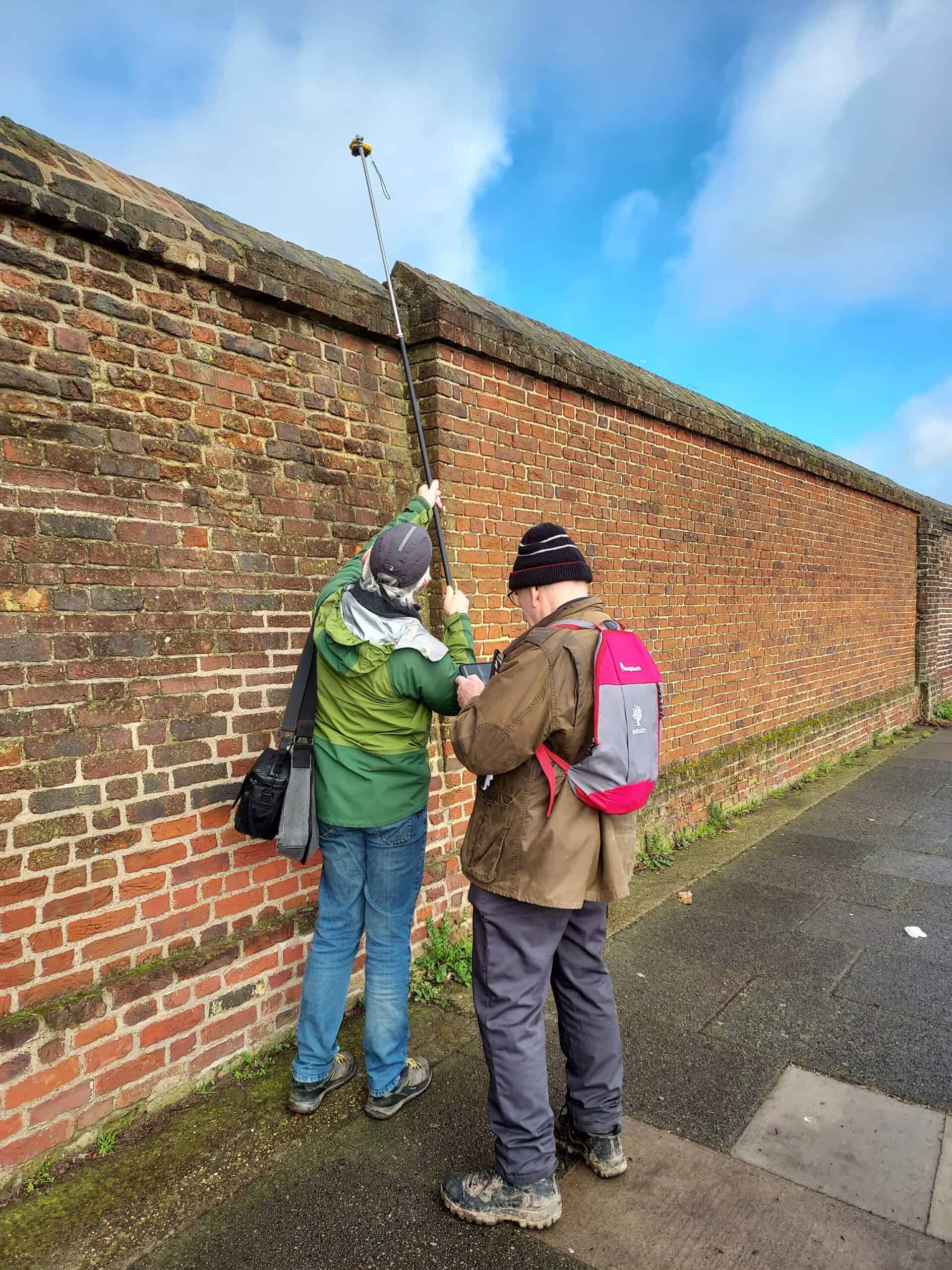
One of our Friends of Greenwich Park volunteers surveying the wall surrounding Greenwich Park. Image credit: Andrew Mayfield – Royal Parks.
As a result, the team are looking at other ways to enable volunteers to add their work to the HER and better tailor work projects to support their needs; story records or thematic records which require less data recording and the ability to create bespoke workflows for users adding data to the HER, are just two features of Arches that will be explored, in addition to the inclusion of built-in help and an overhaul of the GLHER volunteer recording guide.
Arches in use in the British Isles
In addition to Historic England, numerous other heritage organisations and research institutions throughout the British Isles are working with Arches. The City of Lincoln Council was the first UK local authority to implement Arches as its HER database and is currently working to upgrade its platform to the new Arches for HERs application.
Where before, Lincoln’s HER was running on an obsolete database that could only be accessed internally, Arcade, Lincoln’s new heritage information and management platform is a fully online open access tool, allowing anyone in the world to use the council’s heritage data to inform new development proposals, answer academic queries, or simply browse for pleasure.
For the council’s own heritage team, Arches provides access to data entry and query from anywhere that has internet access, as well as a specially designed consultation system for recording professional advice when it is given to customers.
The open-source licence also enables access for as many trusted users as desired, allowing volunteers to contribute information to the database (subject to verification), and for external groups to use the system to support their own projects, such as the ongoing city council’s ‘Local Listing’ project.
Moving from the legacy database to an Arches-based system has, therefore, increased the productivity of the heritage team and opened up new opportunities for the local community to engage with their heritage.
Further roll-out of Arches is gaining momentum
Northern Ireland’s Department for Communities’ Historic Environment Division (HED) records, protects, conserves, and promotes Northern Ireland’s historic environment. Since 2022, HED has been undertaking a digital transformation project to revolutionise how it manages records and to ensure the efficient and appropriate management of Northern Ireland’s heritage.
HED is in the process of deploying a system using the Arches platform to hold its heritage data, to develop bespoke workflows for HED’s broad range of activity and to provide public access to data. HED is currently rolling out use of the system across internal users and it is anticipated that a publicly available version of the system will be available later in 202.
In addition to being implemented by public agencies, Arches is being utilised by several UK-based research institutions for cultural heritage-related work, particularly with an archaeological focus, including University of Oxford, University of Cambridge, University College London, University of Southampton, Ulster University, and Oxford Brookes University.
This includes several projects supported by the Arcadia Fund, a London-based philanthropic foundation, to record endangered cultural heritage within more than 40 countries in the Global South. Each of these projects is implementing Arches employing a wide variety of languages and scripts.
UK Arches community
Arches has a thriving online community made up of worldwide users, developers and service providers, set up to help with the direction of the development of Arches, but also to provide mutual support and encouragement.
Several support groups have been established. In the United States and the UK, regional user groups have been launched for heritage organisations and service providers either using, or having an interest in, Arches as a forum to share information and knowledge about developments in Arches and the range of projects being worked on.
The UK group meets once or twice a year and information about it can be found on the Arches Project website: https://www.archesproject.org/usergroup-uk/. Additionally, with the launch of Arches for HERs, another UK group is being formed that is dedicated to UK HERs using Arches, to look at how to develop the system in the future.
Arches in use internationally
Looking more broadly than the British Isles, to date, Arches is being used by more than 100 organisations and projects around the world as a tool to identify, record, and publish online information about cultural heritage, and for uses including heritage management, protection, and research.
The known implementations to date collectively record more than one million cultural sites spanning five continents and nearly 60 countries. Beyond the British Isles, Arches deployments range from being focused on a national scale in countries such as Jamaica, Barbados, and Canada (now under preparation), a regional scale in British Columbia, Canada, Gansu Province, China, and the State of California (also under preparation), and a city-wide scale in Los Angeles, San Francisco, and Auckland.
For further information on deployments of Arches around the world, visit: https://www.archesproject.org/implementations-of-arches/webpage.
Future of Arches and new possibilities for historic environment information
The numerous Arches deployments to date in the British Isles have provided a range of dividends. In cases such as Jersey and the Isle of Man, they have broken new ground as the first national online HERs, providing public access to consolidated, searchable historic environment information.
For the Greater London and the City of Lincoln’s HERs, they have, for the first time, provided direct online and robustly searchable public access to information. Online, controlled access has also provided new means for authorised volunteer groups to contribute information, extending the capabilities of public agency staff.
The availability of the Arches for HERs application also offers other UK HERs, and their constituencies, the potential to realise similar benefits, such as East Sussex’s HER.
By developing Arches as an open-source software platform that can meet most institutions’ needs, its implementation can free up limited resources for documenting and protecting cultural heritage, rather than being largely devoted to software development or proprietary software licences. Implementing organisations are also able to pool resources for its customisation and enhancement.
The modern, web-based information technologies provided through Arches are also democratising access to information to the public, providing sophisticated, yet intuitive, tools for exploring, discovering and, in some cases, contributing new historic environment information.
Implementations Powered by Arches
ESHER: East Sussex Historic Environment Record
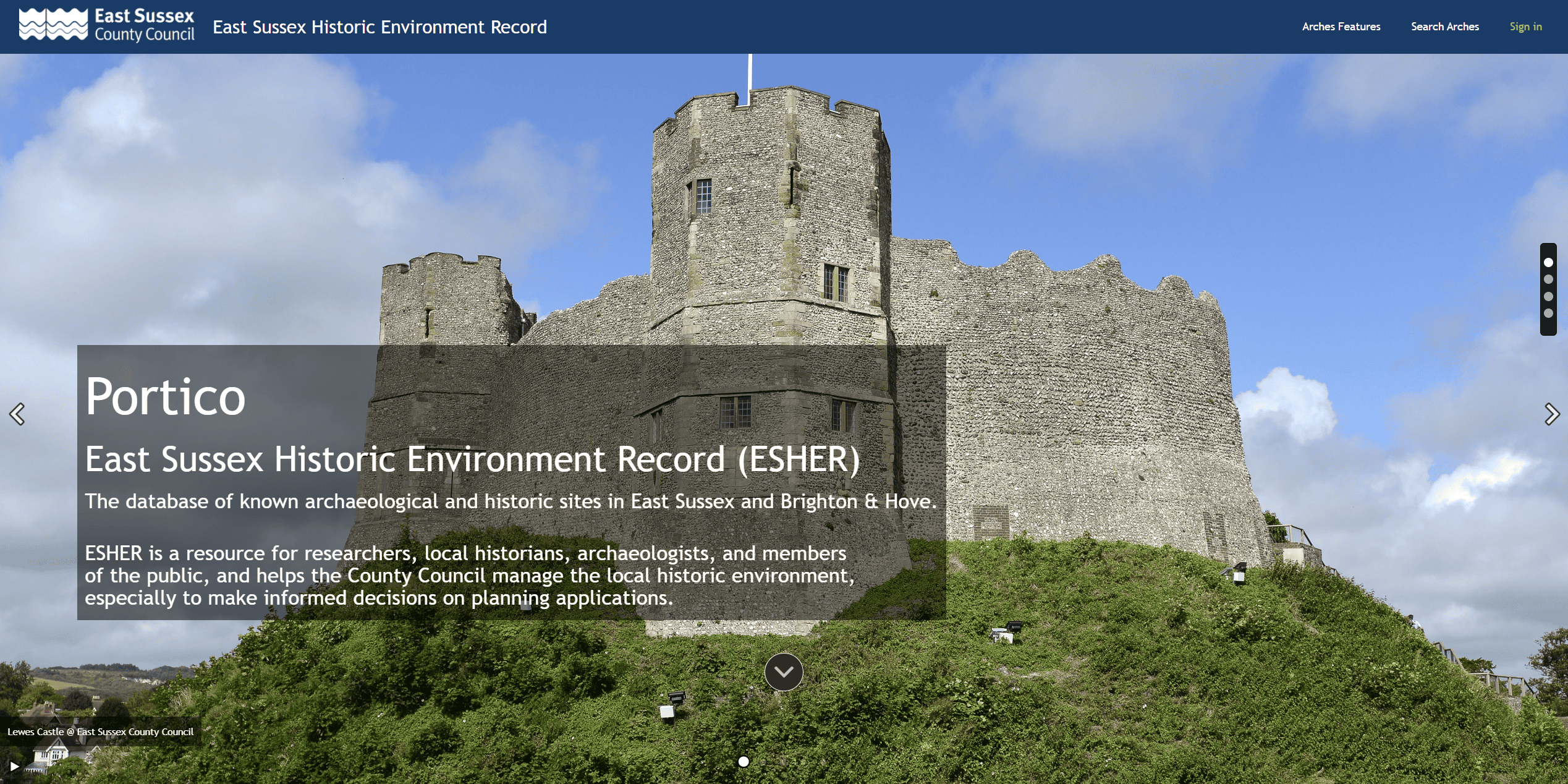
Landing page ofPortico, the East Sussex Historic Environment Record (ESHER), powered by Arches for HERs. Image courtesy of East Sussex County Council.
In 2024, East Sussex Historic Environment Record (ESHER) launched its internal version of the Arches for HERs application, called Portico. ESHER migrated over 35,000 records into the new platform relating to archaeological discoveries, historic buildings, and other historical information.
ESHER’s main purpose is to help the County Council manage the historic environment of East Sussex and Brighton and Hove, enabling informed decisions on planning Applications.
Portico is also a valuable resource for academic and private researchers, local historians, and archaeologists. ESHER ultimately aims to launch public access to Portico.
Jersey Historic Environment Record
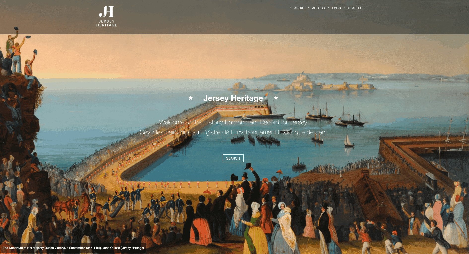
Landing page of Jersey Historic Environment Record (HER), powered by Arches. Image courtesy of Jersey Heritage Trust.
In 2020 Jersey Heritage launched the first historic environment record for Jersey in the Channel Islands as an essential tool for researching its heritage and managing its future.
The online historic environment record for Jersey is powered by Arches and showcases the island’s rich diversity of heritage places, ranging from historic buildings, landscapes, archaeological sites and finds, as well as historical maps and local folklore.
Now, for the first time, comprehensive information about Jersey’s heritage is publicly accessible online providing a valuable research tool for members of the public, commercial entities, and researchers. The Jersey HER website includes a short video guide explaining how to carry out a variety of searches. https://her.jerseyheritage.org/
IOMHER: Isle of Man Historic Environment Record
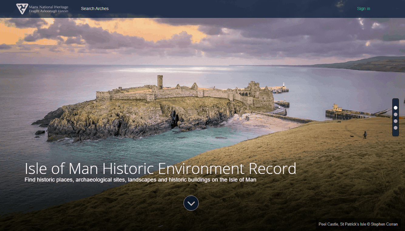
Landing page of Isle of Man Historic Environment Record, powered by Arches. Image courtesy of Manx National Heritage.
Manx National Heritage, the charity responsible for the care and promotion of Isle of Man’s natural and cultural heritage, launched the Arches-powered Isle of Man Historic Environment Record (IOMHER) in 2021. While IOMHERis intended to improve cultural heritage management, it also provides online access for all to information and records relating to the Isle of Man’s rich historic environment. Coverage ranges from data concerning the Island’s significant historic places, including archaeological sites and finds, landscapes and historic buildings, to underwater cultural sites and shipwrecks within Manx territorial waters.
The IOMHER website includes a video tutorial. https://isleofmanher.im/
Coflein
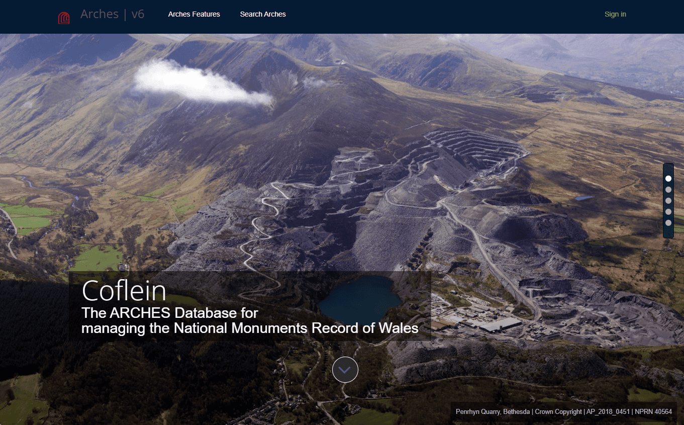
Landing page for the Arches instance serving as an underlying database for Coflein, the Online Catalogue of Archaeology, Buildings, Industrial and Maritime Heritage in Wales. Image courtesy of Royal Commission on the Ancient and Historical Monuments of Wales (RCAHMW).
In 2021, The Royal Commission on the Ancient and Historical Monuments of Wales (RCAHMW) started employing Arches to manage the geographical site index of the National Monuments Record of Wales.
The Commission has deployed Arches as one of the underlying platforms delivering data to Coflein.
The database holds digital images and archive references, and records archaeological and historical sites, monuments, buildings, landscapes and other features relating to the historic environment of Wales. The Arches database currently holds over 120,000 records, created and managed by the RCAHMW, and made available to the public. https://coflein.gov.uk/en/
* Getty Conservation Institute. Pink Floyd black plaque erected at University of Westminster: 2016 Spudgun69; CC BY-SA 4.0. Charles Darwin photograph by Elliot & Fry; public domain. Battersea Power Station: 2013 Tosh Marshall; CC BY-SA 3.0. Red telephone box: 2013 Christoph Braun; CC0 1.0 Universal. Waterloo Bridge from the south bank: 2015 Mike Pennington; CC BY-SA 2.0. Tate Modern viewed from Thames Pleasure Boat: 2003 Christine Matthews; CC BY-SA 2.0. Mary Wollstonecraft, half-length portrait, facing left, photograph of a stipple engraving by James Heath, ca. 1797, after a painting by John Opie; Library of Congress Prints and Photographs Division Washington, D.C.
